Sitting in a shipping container during a Tasmanian winter is Dr Renee Bartolo, who is prepping remote pilots for a voyage down to Antarctica on a summer expedition.
She was hard to contact, because she is often working on projects in remote national parks including wildlife surveys and weed mapping.
Renee holds a remote pilot licence (RePL) and remotely piloted aircraft operator’s certificate (ReOC) to undertake commercial drone operations.
Renee has worked in remote-sensing and earth observation for 25 years and is the Department of Climate Change, Energy, the Environment and Water’s chief remote pilot.
‘I used to watch Samantha Carter flying a drone through the Stargate on TV and sit there thinking that’s what I want to do, I want to be able to do that!’
‘I look back now and that’s exactly what I’m doing with drones to survey amazing ecosystems and landscapes across Australia and training our drone pilots to do the same.’
After completing her PhD in remote sensing at Charles Darwin University, Renee watched drone technology advance across industries, becoming keen to use drones in her own research.
‘In the early stages, we relied heavily on drones that were designed for use by New Zealand defence.’
Drone safety is the biggest priority for drone pilots, and Renee creates a workplace that has continuous safety improvements.
‘I promote a culture that’s open and transparent about reporting of any issues, so that people don’t feel like they’ll be in trouble if they report safety incidences.’
‘Most of the time pilots don’t do anything with intent or negligence, so I encourage everyone to share safety incidences with our drone operator’s group, and that helps us have continuous improvement in our safety systems.’
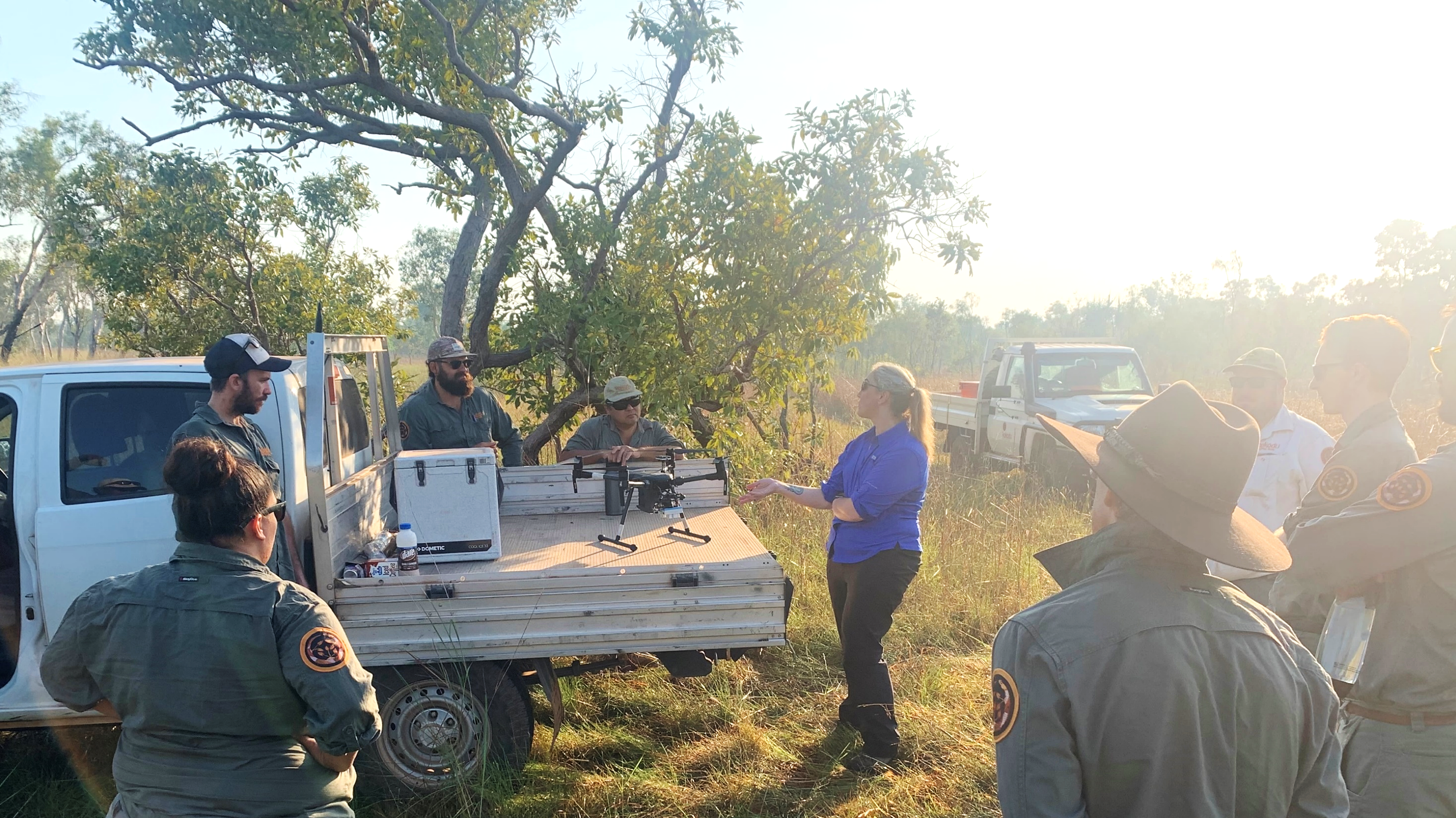
Developments in drone technology have created opportunities for leading edge projects in remote locations where Renee and her team are working with First Nations rangers.
‘We are working on collaborative projects and providing training in some of our national parks, including Kakakdu and Uluru-Kata Tjuta National Parks.
‘We have been undertaking drone surveys of threatened wildlife species and mapping of Buffel grass which is a weed distributed throughout central Australia.
Using drones with a thermal sensor, Renee and the team have trained rangers to conduct surveys for wildlife and search and rescue situations.’
In mapping Buffel grass, the drone follows a predetermined survey flightpath, capturing overlapping photographs from multiple perspectives at specified intervals. Following the drone’s flight, the collected images are used with artificial intelligence approaches to identify the location of Buffel grass.
Renee’s top safety tip is to be always situationally aware.
‘You might have a helicopter suddenly appear in the middle of nowhere. So, you need to be able to respond accordingly and keep an eye and ear out and watch for hazards.’
If you become aware of crewed aircraft operating nearby, you must manoeuvre away and land your drone as quickly and safely as possible.
‘You should always assess your operational area for potential hazards before you fly.’


